You are at - Jotaro's Blog / AhPek Biker / Cycling Malaysia / Penang / Bayan Lepas To Tanjung Tokong via The Kukus Highway
AhPek Biker - Riding Adventures
Penang : Cycling The Kukus Highway - Bayan Lepas To Tanjung Tokong

Penang : Friday, 22nd June 2022
A solo cycling adventure from Bayan Lepas to Tanjung Tokong, via the Bukit Kukus Elevated Highway and along the hinter foothills of Penang Island, with detours to visit interest sights:
Cycling Distance: 42.61 km. | Level: Hard
Time : 10:30 am to 6:45 pm
Time Taken : 8hrs 15mins. (including stops to enjoy beaches & parks, rest, breakfast, lunch, tea-time, and lots of photo opps).
Route Recommendations:
1. Traffic Directions!
Malaysia's traffic is right-hand drive, so drive or cycle on the left. Same thing applies when crossing the road, be careful and take note of the direction in which traffic is approaching from!
2. Route & Traffic Conditions
This route tries to avoid as much as the main roads as possible; it does go along some busy roads but it also went onto quieter river-side paths, residential roads, parks and even through a couple of cemeteries. Generally the route is fairly flat, with a major climb at Jalan Bukit Kukus, and some minor climbs at Boundary Road & Mount Erskine locality.
It's a route of mixed shady and unshaded roads, the over-cast skies did help.
3. Places of Interest
Enroute were several places of interests, some of which we visited and others we did not for lack of time (Note: click on GPS coordinates for directional map to respective places):
- Sungai Bayan Lepas riverside paths (start point at junction of Jalan Garuda & Jalan Tepi Parit (GPS: 5.29469, 100.26368); roughly diagonally opposite the Airport Corner Food Court (GPS: 5.29402, 100.26470),
- Joss Stick Factory (GPS: 5.28651, 100.26037), off Jalan Tepi Parit at Sungai Bayan Lepas riverside.
- Pantai Esen (GPS: 5.27228, 100.26841).
- Bullock Cart Wheel House (GPS: 5.30688, 100.26396).
- Sungai Ara Waterfront (GPS: 5.32530, 100.26698) with the Sungai Ara river flowing through.
- Bukit Kukus Paired Road (GPS: ), presently the highest elevated highway in the country.
- Paya Terubong Flyovers (GPS: 5.35548, 100.27374).
- Relau World War 2 Pillbox (GPS: 5.32960, 100.27576).
- Generation To Generation Mural (GPS: 5.40173, 100.27690) at Air Itam.
- Air Itam Dam (GPS: 5.39462, 100.26368).
- Air Itam Laksa (GPS: 5.40139, 100.27811).
- Penang Turf Club (GPS: 5.41618, 100.29649).
- Jesselton Pocket Park (GPS: 5.42550, 100.30140).
- Konishi Castle (GPS: 5.42243, 100.29874).
- Penang Youth Park (GPS: 5.42934, 100.2976).
4. Food
Breakfast: Fried Noodles at Airport Corner Food Court (GPS: 5.29402, 100.26470), near the car-park of the Penang International Airport.
Morning Tea: Local coffee at D Padang Kafe (GPS: 5.28139, 100.25923), at Permatang Damar Laut.
Afternoon Tea: Penang White Coffee at Yuecheng Tea Garden (悦成茶园) (GPS: 5.32610, 100.27114), at Sungai Ara.
Afternoon Tea: Penang White Coffee at Yuecheng Tea Garden (悦成茶园) (GPS: 5.32610, 100.27114), at Sungai Ara.
Late Lunch: Penang Lor Mee & Pat Poh iced drink at Rifle Range Food Court (GPS: 5.41011, 100.29000) in Air Itam.
5. Weather
July is one of the hottest month in the country, with the east coast of the peninsula enjoying plenty of sunny, dry days; and the west coast experiencing hot and humid conditions, interspersed with short, intense downpours. So do cover up or apply sun-block lotions.
At Penang, mid-afternoon temperatures were 32°C and night temperature averaged 24°C. There was some light drizzle in the late afternoon and evening.
A useful weather forecast site is AccuWeather. For more detailed weather, including cloud cover and wind speed, use Weatherspark and Ventusky.
6. Communicating with Locals
For the uninitiated cycling in foreign lands can be a daunting experience, especially when one can only speak a smattering of the local language or if there is no common language to speak to each other (like English). Most Malaysians can speak fairly good English; but in the rural areas the locals speak only some rudimentary English, so learning some basic phrases in Bahasa Malaysia will be helpful.
This could be partly overcome by using translation apps like Google Translate. Do install this app into your phone and before you leave on your tour do some basic translation as it will be saved onto a list of recent translations.
And do install memory-resident translation apps into your mobile phone.
7. Staying in Touch
When travelling in a group it's important to be able to communicate with each other, especially if one got lost or just to share photos and moments. Pre-paid phone sim-cards are easily available from most phone shops in the main towns.
8. Service Your Bicycles & Carry Tools and Spares
Before leaving on your tour, it will be good to service your bike and bring along some spares like tubes, puncture patches, brake pads and the relevant tools.
___________________________________________________________________________
PRELUDE

I am from Penang and am a proud & loyal Penang Kia. Often I fly back to Penang Island, after landing at Penang International Airport, I would then cycle back to Tanjung Tokong to stay with my mom.... (haha... this AhPek is mama's boy, surprised?)
Usually I will cycle from the airport via the coastal route which will also goes along Penang's East Coast Cycling Lanes and North Coast Cycling Lanes (see A Homecoming Ride blog).

But this time I will be going by a harder route, I will call it the Penang Central Spine Route, as it goes along the edges of the hills near the centre of the Penang Island. This is the new Bukit Kukus Elevated Highway, leading from Lebuhraya Thean Teik in the north to Bukit Jambul and Relau in the south. It runs through the hilly gap formed by Bukit Kukus in the east, and Bukit Bakar Arang & Bukit Susu in the west.
But this new highway is only partially completed, see plan above; and is targeted to be fully completed in 2025.

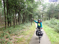
Well it's a bit of an ego thing; see about seven years back we had cycled at the then reputedly highest elevated highway in the country - the 58.2m high Rawang By-Pass (see above photo).
We thought we had done well, AND Then early this year came along the Bukit Kukus Highway, with its highest section completed in January 13th 2022. At 59m high it surpassed the Rawang By-Pass by a nose to become the Malaysia's Highest Elevated Highway! AND for me, it became another milestone to be conquered!
AND WHAT'S THIS? - a blog that starts with a photo of a family sitting on a Chinese tomb? (see top-most photo). This was one of the interesting thing I saw along the way!
READ ON TO FIND OUT MORE!
_________________________________________________________________________
THE RIDE
Route: Bayan Lepas>Pantai Esen>Relau>Sungai Ara Waterfront>Jalan Bukit Kukus>Terubong Flyovers>Air Itam>Rifle Range>Batu Gantung>Jesselton Gardens>Penang Youth Park>Hong Seng Estate>Mount Erskine>Tanjung Tokong.
This route tries to avoid as much as the main roads as possible; it does go along some busy roads but it also went onto quieter river-side paths, residential roads, parks and even through a couple of cemeteries. Generally the route is fairly flat, with a major climb at Jalan Bukit Kukus, and some minor climbs at Boundary Road & the Mount Erskine locality.
It's a route of mixed shady and unshaded roads, the over-cast skies did help.
Cycling Distance: 42.61 km. | Level: Hard
(Click here for the Google Map Bayan Lepas To Tanjung Tokong via Kukus Highway Route Cycling Route Link.)

10:40am - This ride started with a sort of twist. The previous day, I was suppose to fly in and arrive at the Penang International Airport by around 2pm, giving me ample time to cycle the 40+ km. route. But Batik Air rescheduled the flight to arrive at 7 pm instead. Drat! That will be too late and too dark to cycle back!
There have been complains of other airlines rescheduling seats that have been booked much earlier so that the same seats can be sold at a much higher price later! I do hope this is not the case with Batik Air!
Anyway I had promised to tell friends and readers on how riding this route will be. Living up to my promise, the following day, I hailed a Grab ride from Tanjung Tokong to the airport at RM28, telling the driver that I will be cycling from the airport back to Tanjung Tokong! He must have thought that I am one crazy AhPek!

Anyway, I "landed" safely at the airport by Grab taxi .... hahaha! I scooted over to the Airport Corner food court - do not let the name mislead you; this is not inside the airport! Instead it's a small stand-alone food court along Jalan Garuda, near the airport open-air car-park. It serves cheaper affordable food to caters to the air-port staff, taxi-drivers and others (like this AhPek) looking for cheaper affordable food. Here I had a quick breakfast of mee goreng before starting off my ride.
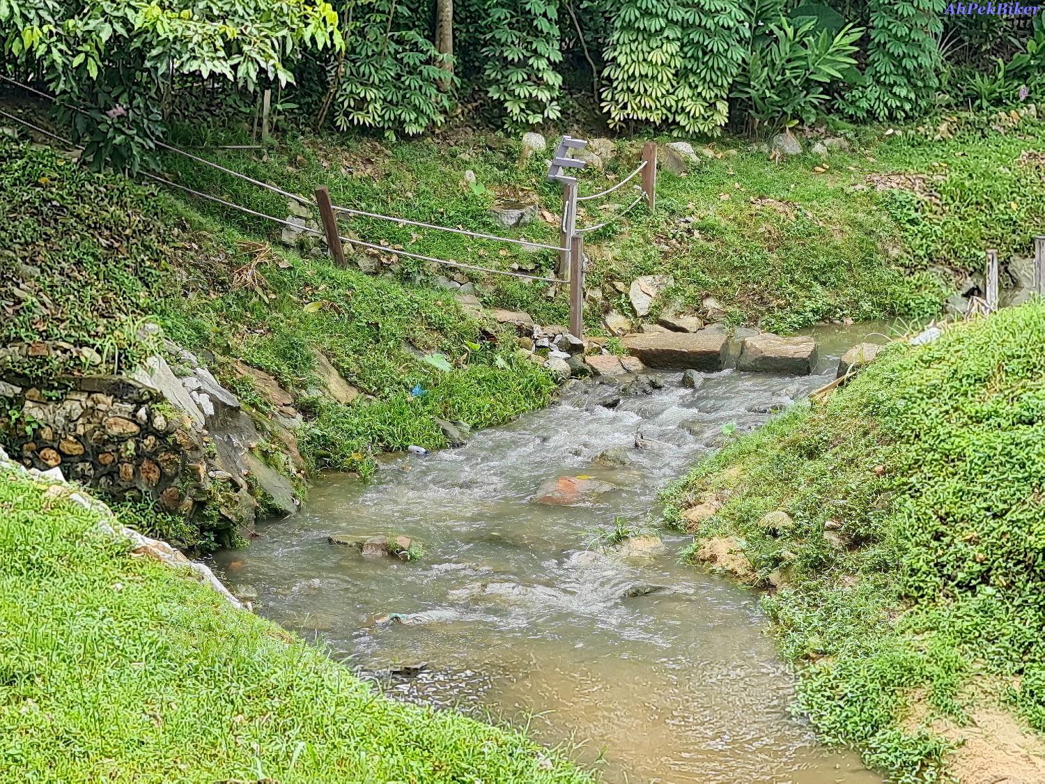
From the food-court, I went diagonally to ride along the appropriately named Jalan Tepi Parit (which means river-side road in Bahasa Malaysia); this is a quiet river-side path that runs beside Sungai Bayan Lepas and leads to the coastal main road. I like riding here, it's almost traffic free - serene with beautiful scenes (see above photo and the top-most photo)

But I am not the only one enjoying the riverside peaceful solitude, along the way I notice several monitor lizards, these were quite big; almost 5 to 6 feet long! This morning's overcast cool weather had encourage them to come out. I often ride along this route on the way out from the airport, now one can see why - it's so green here and the air is so fresh!

While here do pop in to visit a joss stick factory to one side of the river-side road. This factory makes huge giant joss-sticks that are usually lit at the front of Chinese temples. They also make the giant dragon joss-sticks. According to the owner, they have been here for a couple of decades!

Jalan Tepi Parit does not lead all the way to the coastal road, but instead becomes a gravel road that leads to Kampung Binjai. To continue to the coastal road, just after the joss-stick factory make a left at a bridge to cross over to the other side of Sungai Bayan Lepas, and ride along Jalan Kolam Ikan - not far ahead is the coastal road i.e. Jalan Permatang Damar Laut.

Just into Jalan Permatang Damar Laut, if one is lucky one will see planes approaching to land at the airport. I wasn't so lucky this time, the above photo is from an earlier ride to Gertak Sanggul!

Having heard much about Pantai Esen with it's beautiful, pristine beaches, I decided to take a detour there to experience the place for my self. To reach this beach is via Jalan Permatang Damar Laut which is a 4-lane carraige-way with a central raised divider; the entry point to cross over to Kampung Permatang Damar Laut (and from there to the beach) is at the junction where Yeaw Seng Motor Services is (GPS: 5.27611, 100.26883), do be careful as this is a busy junction. From here tarred roads will lead up till the Pantai Esen ATV Extreme Park (GPS: 5.27170, 100.26899); after which it's gravel/laterite tracks which goes up and down slopes. Cycling here is not easy on the 16" wheel Brompton and at certain steep/rough stretches I had to come down and push.

11:50am - But it was a worthwhile effort, the beach is beautiful and calm - quite as it was a weekday. Nice as can be seen in the photos above (which were taken by some helpful young ladies having a picnic there).

I would have love to cycle further in to view places further in (such as Esen Hill, Tua Pek Kong Shrine, etc.); but the tracks got sandy and rougher and I reluctantly turned back. Perhaps next time I will come with a mountain bike or to hike!
Happy, I rode back out stopping for a cuppa at the D Padang Kafe road-side stall, which is aptly near Kampung Seronok (which means "Enjoyable Village" in Bahasa Malaysia). Just for note, somewhere at the beach near here is the unique Permatang Damar Laut British WW2 Bunker (GPS: 5.27868, 100.26003). It's not accessible by bicycle as it's on a sandy beach.


Nearby at Sungai Ara, the Fig Tree Hill Resort has bullock cart wheels in there theme too..


These are through the efforts of a local group called Riverside Funmers - who take farming to a fun level!

At the nearby Guan Yu Temple celebrations were ongoing to celebrate the birthday of the deity - Guan Yu. - who is more familiarly know as Guan Di; the God of War. and legendary renown for his loyalty and righteousness. Preparations were being made for the evening's festivities with orange-coloured pineapple candles all laid out with the names of devotees tagged onto them.


I had a nice interlude of Penang White Coffee at the Yuecheng Tea Garden (悦成茶园), it's a welcomed short break as a tough stretch lay ahead - the Bukit Kukus Elevated Highway!


Air Itam, nestled at the foothills of Penang Hill, is one of the most happening places of the island. Almost as old as George Town, it was first developed in the late 18th century, soon after the founding of Penang Island by Captain Francis Light in 1786. British East India Company officials intended to turn Air Itam, including Penang Hill, into an agricultural area and established spice farms. To this day, fruits and vegetables are still grown at the hills of Air Itam; fresh produce are then brought downhill daily to the wet markets throughout George Town.
The mural signifies the generations that have settled down here and established its lively environment. Making it all the more important to pass on the culture to the next generation as shown in the mural. The number ‘11500’ is the postal code of Air Itam.

Goofy (my copper-plated Brompton P6R) with a much better view of the Kek Lok Si Temple & the Guan Yin Statue in the back-ground.

I had intended to to cycle along those tracks the following day, but had to abandon it due to a change of plans. Anyway, Click here for the Google Air Itam Dam To Balik Pulau Cycling Route Map Link.


(and said more prayers to ask permission to pass through and also to take this photo).

This AhPek will have to go for knee surgery in late August 2022, and will be in a better shape to continue with more riding adventures. And will stop writing this blog, to be continued after my operation.
2nd September 2022
Hi! I am back after a knee cap replacement surgery done at the Ara Damansara Medical Centre. My left knee was badly bent due to bow-leggedness and it became difficult and painful to walk. Knee surgery had to be done to straighten my leg so that I could walk without pain. More details of this in another blog, in the meantime let's continue on with the blog on this ride:


No cars are allowed into Pesiaran Kuari so it's CAR-FREE.... hooray!
This area holds a lot of memories of younger days; at one far corner is a small water fall and behind it are hiking trails that start from opposite rear of the Western Road Catholic Cemetery and the lead up to concrete swimming pools at Strawberry Hill and then onwards to Penang Hill. It was also at the Youth Park that I got bitten by a snake during scouting days. That's a twisty tale told in another blog.


 |
| Hong Seng Estate aerial photo (from Penang Monthly Magazine; (Composite photo was created by Eugene Quah from drone footage courtesy of Eddy De Vosse. https://www.youtube.com/channel/UCUUdQcmJnUE-Ro92UMUwawA) |
"Hong Seng Estate, with it's main access from Jalan Mount Erskine, was founded in 1803 by Oh Chong Leng (胡宗宁), a businessman from Amoy (Xiàmén), The Estate covers 25 hectares of land in total, with the village taking up around 11.5 hectares. To open up the land plots were leased out to settlers at a monthly rental of RM40 per land plot. The settlers erected houses on the land, and their descendants today continue to pay no more than RM70 per month in rent to the trustees.
(Write up on the above photo is a condensed extract from an article titled "Hong Seng Estate: The Urban Kampung by the Hill" by Eugene Quah and published in the July 2022 issue of the Penang Monthly Magazine. To read the full article, subscribe to Penang Monthly, they have interesting and in depth articles on Penang, including a couple of Penang cycling articles by this AhPek!)
(Write up on the above photo is a condensed extract from an article titled "Hong Seng Estate: The Urban Kampung by the Hill" by Eugene Quah and published in the July 2022 issue of the Penang Monthly Magazine. To read the full article, subscribe to Penang Monthly, they have interesting and in depth articles on Penang, including a couple of Penang cycling articles by this AhPek!)

Being partly surrounded by the cemetery, some of the houses literally sits next to tombs, as can be seen in above photo (photo by Eugene Quah from Penang Monthly Magazine).

Prior to doing this ride, I had read interesting posts on WWII bunkers in the Penang Walkabouts FaceBook group and was on the lookout for these during my ride. Saw the above two which are located at the adjacent cemetery along the access road leading out from Hong Seng Estate to Jalan Mount Erskine. I had missed the ones at Permatang Damar Laut & Relau.

What I saw next quite surprised me! It was a local family sitting on one of the tombs near the bunkers. But why were they happily sitting there?

I turned around and saw what they saw - a beautiful panoramic view of Gurney Drive and George Town! The tombs here follows the good feng shui principal of "sitting on mountains, viewing the sea". With it's unfettered view, it was also a strategic location for the war bunkers!
I posted the above photos in a Penang Walkabouts FB group and was bombarded with comments!
Some from those who were familiar with the location (as can be seen in the previous photos of Hong Seng Estate), and with local customs were good and understanding; while others where shocked and complained about the rudeness of the family, see the comments at this link here.
But the FB posting also brought about a good thing; the tomb is that of Mr. Wong Kam Poh (a renown Penang Footballer during the 1950s) & his wife. And family members who saw the photo were happy to share the story of their father, and also their own photo of the tomb! It also brought about Mr. Wong's son & daughter reconnecting with some old childhood friends whom they have not seen for decades!

And after that it's a home-run stretch passing by two more World WarI I bunkers along JME.
For those interested there is another impressive one at Tanjung Tokong near the Pearl Garden Cafe, a few kilometres away.
POST-SCRIPT

Poor Goofy's the leather seat of its Brooks B17 Saddle had got torn and it's nose had dropped off. It's suppose to have a TEN year guarantee, but too bad it's a few months past it's 10th year life.
Any way it was quiet an adventure, as from Riffle Range Road onwards, I hardly used the main roads!
And here's a nice YouTube video of Bkt. Kukus Highway by Yihchang.
__________________________________________________________________________
Related/Similar Blogs:
__________________________________________________________________________
Related/Similar Blogs:
 |
 |
 |
 |
 |
___________________________________________________________________________
You may also like:
 |
 |
 |
 |
 |
 |
 |
 |
 |


You are at - Jotaro's Blog / AhPek Biker / Cycling Malaysia / Penang / Bayan Lepas To Tanjung Tokong via The Kukus Highway
If you like this, view my other blogs at Jotaro's Blog
(comments most welcomed below. if you like this pls share via facebook or twitter)
No comments:
Post a Comment