You are at - Jotaro's Blog / AhPek Biker / Cycling Malaysia / Perlis-Kedah-Penang / Perlis to Penang / Day 5 - Cycling Penang Island | Go to D1 / D2 / D3 / D4
AhPek Biker - Riding Adventures
Cycling Perlis to Penang : Day 5 - Penang Cycling Lanes & The Bridge of Hope

Tanjung Tokong (Island Plaza)>Gurney Drive>Penang Town Hall>Karpal Singh Drive>Queensbay>Bridge of Hope (Jambatan Harapan)>2nd Penang Bridge and back.
Cycling Distance: 51.38 km. Level: Medium
Cycling Time : 7:30 am to 11:15pm
Time Taken :3hrs 45mins (inclusive of stops for breakfast, morning tea, attending launch of cycling lanes, rest, regrouping, and many photo opps).
This is page 5 of a 5-page blog, Click Here To Go To Title Page.
Route Recommendations :
1. Traffic Directions!
Malaysia's traffic is right-hand drive, so cycle on the left. Same thing applies when crossing the road, be careful and take note of the direction in which traffic is approaching from!
2. Route & Traffic Conditions
The route is generally flat, and road conditions good except for a couple of stretches of the coastal road which were muddy and full of rubbish.
3. Navigation
Where data signal is available and strong, one can use Google Maps to navigate around. If the cycling options may not be available, just use the walking options.
In cases where data signal is weak or unavailable (like in remote rural areas), install MAP.ME into your phone. It's an off-line map app.
Alternatively, use a dedicated GPS unit like those from Garmin. However ensure that one install the Malaysia maps into the unit.
4. Weather
At Penang Island, daytime temperatures averaged 33°C, with sunny skies. Evening temperature averaged 23°C.
A useful weather forecast sites is AccuWeather. For more detailed weather, including cloud cover and wind speed, use Weatherspark and Ventusky.
5. Places of Interests
Along the route were several places of interests, some of which we visited others we did not for lack of time. (Note: click on the GPS coordinates for the directional map to the respective places):
- Shui Bee Keong Temple (GPS: 5.44174, 100.30698) and old temple at Tanjung Tokong, opposite the fire station.
- Penang North Coast Cycling Lanes, starting from Precint 10 (GPS: 5.44964, 100.30551) in Tanjung Tokong till the Penang Town Hal (GPS: 5.42108, 100.34139) at the Esplanade.
- Cyclist Monument at the GSD Cycling Park (GPS: 5.33916, 100.31127) along the Penang East Coast Cycling Lanes.
- Seahorse Pocket Park (GPS: 5.33303, 100.30860) located near Queensbay Mall.
- Cycling Bridge of Hope (GPS: 5.32787, 100.30631). GPS is location of the flat bridge joining to Phase 2 of the cycling lanes.
- Section One of Phase 2 of the Penang East Coast Cycling Lanes; starting from the Cycling Bridge of Hope till a cycling bridge (GPS: 5.29768, 100.29536) just before the Second Penang Bridge.
6. Food
7. Communicating with Locals
For the uninitiated cycling in foreign lands can be a daunting experience, especially when one can only speak a smattering of the local language or if there is no common language to speak to each other (like English). The language of the country is Bahasa Malaysia, and many urban Malaysians can speak fairly good English; but in the rural areas the locals speak only some rudimentary English, so learning some basic phrases will be helpful.
This could be partly overcome by using translation apps like Google Translate. Do install this app into your phone and before you leave on your tour do some basic translation as it will be saved onto a list of recent translations.
And do install memory-resident translation apps into your mobile phone.
8. Staying in Touch
When travelling in a group it's important to be able to communicate with each other, especially if one got lost or just to share photos and moments. Pre-paid phone sim-cards are easily available from most phone shops in the main towns.
9. Service Your Bicycles & Carry Tools and Spares
Before leaving on your tour, it will be good to service your bike and bring along some spares like tubes, puncture patches, brake pads with the relevant tools.
_________________________________________________________________________
PRELUDE

_________________________________________________________________________
THE RIDE
Cycling Route: Tanjung Tokong (Island Plaza)>Gurney Drive>Penang Town Hall>Karpal Singh Drive>Queensbay>Bridge of Hope (Jambatan Harapan)>2nd Penang Bridge and back.
This is a casual route that goes mostly along the cycling lanes of Penang Island, starting from Tanjung Tokong and reaching almost to the 2nd Penang Bridge before looping back.
Cycling Distance: 45.38 km. Level: Medium
(Click Here for Google route map link)
THE PENANG NORTH COAST CYCLING LANES

7:00am - A few of us gathered with other cyclists to support the launch of the Penang North Coast Cycling Lanes. These lanes have been put up a few months earlier and today the new Chief Minister of Penang, YB Chow Kon Yeow is officiating its launch starting with a speech of the state's effort in the development of cycling lanes. The launch will be followed by a ride along these new lanes.

This is the Penang Cycling Master Plan for the development and implementation of cycling lanes on Penang Island. Only the Eastern Coastal Route and Northern Coastal Route are dedicated cycling lanes, the rest are shared lanes (although there are short dedicated lanes at Balik Pulau). A total of 200km of cycling lanes are planed and 90% have been completed. That's quite a feat considering that all of this started when the former Chief Minister YB Lim Guan Eng officiated the first launch of the Penang Cycling Lanes just five years ago in August 2013!

Above is a cycling map of George Town graciously prepared by our buddy Chin Huat, click on it for an enlarged view. It also shows some of the radial lanes that cut inwards into the island.

Among the people gathered here, I saw several wearing the Bike-on-Friday (BOF) T-shirts. This is also an initiative by the G-Club Penang Cyclists and the state to encourage people to cycle to work. Cyclists meet every Friday in comradeship to cycle to their places of work. At the North Coast the meet up point is Island Plaza and at the East Coast it's at Karpal Singh Drive.

And here are my supportive friends; AND they were there five years ago too, during the first launch of the Penang Cycling Lanes, after which we scratched our cycling itch and did a short ride to Pearl Hill.

Many others came too, in their different bicycles - road bike, racers, foldies. One lady demonstrated how easy and compact her Nanoo Bicycle folds. It was also good to see this man and his two young boys; they being instilled with a cycling culture at a young age.

After a informative speech, the Chief Minister cut a red ribbon strung across the new lane. This automatically released a colourful bunch of balloons. After watching them float away high into the sky, we set off.

We started off riding on lanes running on shared concrete pavements along Jalan Tanjoung Tokong, some were newly cast concrete ones. The more important things were the newly erected railing that were erected at the outer edges, ensuring the safety of all using these pavements. The rider here is from LinkBike, a public bicycle sharing system which serves George Town.

At the Shui Bee Keong Temple (槟城水美宫), the lanes narrowed to a single-cycle width. Built in the late 19th century, the temple appears new due to the renovations done on it over the years. The original wooden pillars have now been replaced by masonry. It has been here for ages, even before Jalan Tanjoung Tokong was widened to a four lane carriage-way. The road widening took up some of the temple grounds, hence the narrowness of the lanes here; on the temple side red hoarding had been put up.

We took a left turn into Persiaran Gurney (Gurney Drive) and were now riding on the older pavements running along the seaward side of the road. This is a shared lane, and this area could be pretty busy with many pedestrians, cycle with care and consideration of other users.
On the seaward side, green fencing planted with creepers had been put up; these masked the massive 900 acres land reclamation project that stretches from Tanjung Tokong to Gurney Drive. "A 24.28 hectare (60 acres) section fronting the promenade is expected to be completed by 2020. This will be called the Gurney Wharf - a seafront park which will comprise of four distinct recreational areas - a beach, a coastal grove, a water garden, and a seaside retail food and beverages (F&B) area. Also created will be a 760 acres new island for private housing and commercial development."
Gone will be the present public promenade lined with mobile hawker stalls; to many just sitting at the low walls here and enjoying the sea-breeze were just simple enough entertainment. With the modern park coming up, will these simple socializing be just memories of the past OR will the state government create a similar environment up at the new seafront? For a feel of Gurney Drive presently or in the past, click here. Read more of this reclamation project here. For a map of the project click here.

Beyond the far end, just as the road turns right to join Jalan Sultan Ahmad Shah (Northam Road), sampan fishing boats are moored at the seaside. This is my favourite spot of Gurney Drive, it seems like an oasis of calm amid the now more busy and touristy promenade.

Most of the tall, shady trees of Northam Road were still there and the lanes meandered along below them. At times a tilting giant trunk leans over low and we swerved to avoid them. But we don't mind - the lanes should make way for the trees instead of the trees being cut down to give way to the lanes. These trees have been around for more than a century and have been part of this road scenery for a long, long time. Many of them are as old as, or even older than the large colonial mansions lining the road.

The stretch fronting the E&O Hotel runs along a pavement with unaligned lamp-posts and street signs. Some of my buddies found it difficult to ride here and went onto the road instead.

At the bend of Light Street, the lanes are shared ones before turns into Padang Kota Lama (the Esplanade). Here the North Coast Lanes ends and merges with the East Coast Lanes.
These shared lanes continue on to join the Penang East Coast Cycling Lanes starting from Pengkalan Weld (Weld Quay). The dedicated cycling lanes of the East Coast starts at the "Crooked Bridge" at the far-end of Weld Quay.

Near the Penang Town Hall we met up with a large group of our friends who had congregated here as it it the start and end point of tomorrows CFAL-10 event. Actually they were good friends, and have gathered here to wait for us as it is a favourite meeting place. Erected here was a large billboard with names of the participants printed onto them, we took turns to eagerly look for our names among the thousands.

8:15am - About twenty of us rode off and soon stopped for breakfast at Xen Teck Cafe situated at the entrance of the Tan Clan Jetty. Penang is renown for its street food and here we had a good choice ranging from Hokkien Prawn Mee, Curry Mee to Lor Bak. I had my favourite - Penang Char Kueh Teow; I like this so much that I can easily wolf down three plates of them per day 😋.
THE PENANG EAST COAST CYCLING LANES

Here we are at the "Crooked Cycling Bridge"; instead of coming in from the Jelutong Expressway, had entered in via the residential area of Pintasan Cecil. We call this the crooked bridge as it forms a crooked S with it's hooked approaches. We are all still looking fresh, well rejuvenated by the many Penang food we had. This is where the dedicated lanes of Phase 1 of the East Coast Cycling Lanes start and continue along Karpal Singh Drive to head towards Queensbay. Please note that the map above does not show the route along the cycling lane as I could not plot a direction map on them using Google Maps; for actual route map along the Phase 1 of the cycling lanes, click here.

I always like cycling along here, although running just next to the Jelutong Expressway way, the lanes are well shaded, very green and serene.

At Batu Uban, we swing away from the highway. Here the lanes run along reclaimed land and often they are rerouted to make way for the new developments, but all is well taken care off as new lanes were built at these diversions.

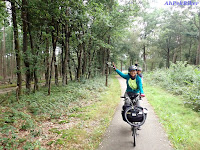
Another beautiful stretch that runs through wooded area near the Gold Coast Condominiums. Some of my buddies who had not rode on these lanes before were thoroughly enjoying themselves. The lanes run under the First Penang Bridge, through fishing piers, and many green sections. It's all so natural and also brings one in contact with the local life. Because of this, I think the Penang Cycling Lanes are so much better than Singapore's Park Connector Network which just runs clinically through hygienically clean parks without much chance to interact with local village life.

Within this area is another favourite spot, the GSD Cycling Park. We rested for a while, having much fun climbing up to pose with the cyclists sculpture.

Goofy feeling very cozy at the Sea-horse Pocket Park opposite Queensbay Mall.

At the stretch along the Persiaran Bayan Indah Seaside Recreation Park, we met up with members of the Brompton World Travellers Group. They had started earlier and were on the way back to town. Wow! They were even wearing specially printed T-shirts for their trip up for CFAL-10; I wondered how much they paid for them. Initially I thought the PNG on the T-shirts stood for Papua New Guinea. Silly old me, it stands for PeNanG.

11:15AM - The most important destination of our ride - the spiral Jambatan Harapan (Bridge of Hope). Launched in 20th May, 2018, this bridge allows cyclists and pedestrian to cross the expressway which is 11 meters below.
This spiral bridge was built by the Penang Island City Council at a cost of almost RM9million. This also includes the construction of the bridges for bicycles across Sungai Nibong Kecil and Sungai Ara. The left fork connects to the Phase 2 of the East Coast Cycling Lanes.

The bridge is a 3-storey structure with spiral ramps leading up to the top-most, and from there a long ramp goes over the Jelutong Expressway to cycling lanes on the other side that radially leads Bayan Baru.

From the top, one can have scenic panoramic views of the coastline, the sea and Pulau Jerejak Island.

The lanes that leads to Bayan Baru comes with two cycling lanes and a walking path. It slopes down gradually to join the Sungai Nibong Highway and then onwards to Bayan Baru and Bukit Jambul.

But for today, we are more interested in the bridge that spans across the Sungai Nibong Kecil and connects to Phase 2 of the East Coast Cycling Lanes. To use this, one don't even have to go up the spiral bridge, just before it take the left fork.

This stretch runs parallel to the Bayan Lepas Expressway and mostly along the seaside with several sections meandering inwards.

Phase 2 is suppose to run all the way up to Batu Maung and from there connect to the Penang International Airport. It then connects to shared lanes that goes round Penang Island.
But for the moment the lanes a completed just shy of the 2nd Penang Bridge. We patiently look forward to it's completion.

I would have loved to take my buddies to the Pt.01 milestone of the 2nd Penang Bridge which is located on a small promontory just next to the bridge. But this would have entailed dangerously crossing the highway, so we didn't risk it. Presently, this place is a vacant land. I do hope that it will be turned into a pocket park and won't be turned into a private residential or commercial development.
Above photo is of Goofy (my bike) taken a couple of years back when I cycled from Bayan Lepas to Tanjung Tokong after flying in from Kuala Lumpur.

We looped back down to George Town reaching the crooked lanes near Penang Road. While my friends went onwards to Little India, I left to see relatives who had flown in from overseas.
TILL WE RIDE AGAIN,
CHEERS!
CHEERS!
(For more photos of the day Click Here)
This is page 5 of a 5-page blog, Click Here To Go To Title Page.
__________________________________________________________
Related Blogs:
 |
 |
 |
 |
 |
 |
 |
 |
You may also like:
 |
 |
 |
 |
 |
 |
 |
 |
| Street Art of Gopeng, Perak : July 2014 The street art culture is spreading and is now budding in Gopeng. |
 |
 |
 |
 |
 |
 |
 |
 |
| Malaysia - KevinTheBigCity Tattoos, Kuala Lumpur : July 2014 A look at a young man's simple but meaningful tattoos. |
You are at - Jotaro's Blog / AhPek Biker / Cycling Malaysia / Perlis-Kedah-Penang / Perlis to Penang / Day 5 - Cycling Penang Island | Go to D1 / D2 / D3 / D4
If you like this, view my other blogs at Jotaro's Blog
(comments most welcomed below. if you like this pls share via facebook or twitter)
(comments most welcomed below. if you like this pls share via facebook or twitter)
No comments:
Post a Comment