You are at - Jotaro's Blog / AhPek Biker / Cycling Malaysia / Perlis-Kedah-Penang / Perlis to Penang / Day 3 - Ayer Hitam To Yan | Go to D1 / D2 / D4 / D5
AhPek Biker - Riding Adventures
Cycling Perlis to Penang : Day 3 Ayer Hitam To Yan - Of Museums & Dreamy Fishes

Cycling Distance: 70.00 km. Level: Medium
Cycling Time : 8:55 am to 7:10pm
Time Taken : 10hrs 15mins (inclusive of stops for breakfast, lunch, visiting museum and Pulau Bunting, puncture repairs, rest, regrouping, and many photo opps).
This is page 3 of a 5-page blog, Click Here To Go To Title Page.
Route Recommendations :
1. Traffic Directions!
Malaysia's traffic is right-hand drive, so cycle on the left. Same thing applies when crossing the road, be careful and take note of the direction in which traffic is approaching from!
2. Route & Traffic Conditions
The route is generally flat, and road conditions good except for a couple of stretches of the coastal road which were muddy and full of rubbish.
3. Navigation
Where data signal is available and strong, one can use Google Maps to navigate around. If the cycling options may not be available, just use the walking options.
In cases where data signal is weak or unavailable (like in remote rural areas), install MAP.ME into your phone. It's an off-line map app.
Alternatively, use a dedicated GPS unit like those from Garmin. However ensure that one install the Malaysia maps into the unit.
4. Weather
At Kuala Kedah, daytime temperatures averaged 30°C, but overcast skies made it feel cooler. Starting from the morning, there were several short spells of rain.
A useful weather forecast sites is AccuWeather. For more detailed weather, including cloud cover and wind speed, use Weatherspark and Ventusky.
5. Places of Interests
Along the route were several places of interests, some of which we visited others we did not for lack of time. (Note: click on the GPS coordinates for the directional map to the respective places):
- Ayer Hitam Canal Bridge View (GPS: 6.22912, 100.24218).
- Kuala Kuar Fishing Pier (GPS: 6.17471, 100.2637).
- Jambatan Tok Pasai Bridge (GPS: 6.10931, 100.29429) spanning the Sungai Kedah River.
- Pulau Bunting and the Pulau Bunting Bridge (GPS: 5.87880, 100.34703).
- Pantai Murni Waterfront (GPS: 5.79486, 100.36755) in Yan.
6. Food
- Breakfast: Curry Noodles at Fragrant Food Coffee-Shop (香香美食) (GPS :6.24041, 100.24569) in Kampung Lubuk Ayer, Ayer Hitam.
- Lunch: Rice with Gulai Temenong fish curry (Dreamy Curry) at Gulai Termenung Tok Piah Claypot Shop (GPS: 6.11092, 100.29208) in Kuala Kedah.
- Dinner: Thai noodles and western dishes at Thara Thai Seafood Restaurant (GPS: 5.79745, 100.37282) in Yan.
7. Accomodations
At Pantai Murni in Yan, we stayed at the Kesuma Homestay Pantai Murni (GPS: 5.79419, 100.36788). We took an end lot house with three bedrooms, living room, dining room and kitchen for a night at a total of RM300/-.
Address: Jalan Pantai Murni, Kampung Pantai Murni, 06900 Yan, Kedah.
Tel.: +6012-4310685 / +6012-4260685
8. Communicating with Locals
For the uninitiated cycling in foreign lands can be a daunting experience, especially when one can only speak a smattering of the local language or if there is no common language to speak to each other (like English). The language of the country is Bahasa Malaysia, and many urban Malaysians can speak fairly good English; but in the rural areas the locals speak only some rudimentary English, so learning some basic phrases will be helpful.
This could be partly overcome by using translation apps like Google Translate. Do install this app into your phone and before you leave on your tour do some basic translation as it will be saved onto a list of recent translations.
And do install memory-resident translation apps into your mobile phone.
9. Staying in Touch
When travelling in a group it's important to be able to communicate with each other, especially if one got lost or just to share photos and moments. Pre-paid phone sim-cards are easily available from most phone shops in the main towns.
10. Service Your Bicycles & Carry Tools and Spares
Before leaving on your tour, it will be good to service your bike and bring along some spares like tubes, puncture patches, brake pads with the relevant tools.
_________________________________________________________________________
PRELUDE

_________________________________________________________________________
THE RIDE
The route is mainly on the coast and starts from Ayer Hitam at the border of Kedah and Perlis goes along a canal to head for the coast. At several stretches it detours slightly inland to avoid the bad coastal tracks (which were muddy or full of rubbish). It goes through several fishing villages and the town of Kuala Kedah. Just before ending at Yan, was a detour to Pulau Bunting along the Bunting Island Bridge.
Cycling Distance: 70.00 km. Level: Medium
(Click Here for Google route map link)
 Early morning we woke up to very dark skies and heavy rain. What to shall we do?..... just roll back and continue sleeping like lazy dogs💤💤💤❗
The rain petered off to a drizzle, and by nine we set off, 1-1/2 hours later than usual. Never mind, we will make up for it by cycling faster or perhaps have less stops along the way. Can we resist the temptations along the way?
 We rode off along a road running next to a canal, it's so quiet and cooling and just about 200 metres away from the busy main roads. One should always seek alternatives than the main roads, it may stretch the distance a bit but often there are often jewels like these to be found.
 Along this road at Kampung Lubok Ayer was a gem of a coffee-shop selling very good curry mee noodles and fantastic local coffee to perk up our lazy bones on this cold morning. I don't know the name of the shop (it's written in Chinese on a small shopfront board and this banana can't Chinese), anyway the GPS is 6.24025, 100.2458. Other than the food, what made this shop special is that the owner is a collector of antiques. Pop into the back of the shop and their are piles of old stuff, including antiquarian steel safes, old lamps, etc.
 9:45am - Temptation Numero Uno. A scenic view of reflections at a bridge across a wide canal at Kampung Kuala Jerlun. We stopped to take many photos and also talked to passer-bys who were curious about how "funny" bikes and where we were heading.
 Poor Brian, even as we cycled along he was receiving calls about work. Often he stopped to reply but at times he just continued riding on. It's a good thing that the roads here are almost devoid of traffic and that he is also one of the most experienced cyclists around.
 Brian wasn't the only busy one around, the locals folks were out in force to do their daily morning marketing. The shops here are small and don't stock up much as the community here is not big.
 10:15am - Temptation No. 2. We have just reached the seaside at Kampung Jeruju, a solitary green tree sticking out at a bare patch attracted us... more photos... heh, heh!
 10:45am - Temptation No. 3. At Kuala Kuar, long jetty sticking out to the sea with boats clustering at one side.
 But it was not all the time pretty and easy; ahead the road became bad, with many filled with puddles of water. We had to ride slow and maneuvered a zig-zag pattern to avoid them; who knows what's inside them. Worse still, rubbish had been dump at several stretches. Brian by now is off his phone, concentrating on ziggy-zagging!
 Disaster hit! Brian's bike had a puncture. Fortunately, it was the front tire and with a quick patch work were were off again. But then his tire kept on deflating and he had to do three more patch jobs. We finally found out the cause, a tiny, very short staple like pin! See the rubbish around us? Because of the debris, it's advisable to avoid this section that stretches from Kuala Kuar to Padang Garam.
 Approaching Kota Kuala Kedah, we were glad to get away from the debris-filled road and onto wider roads. Traffic was super light here and we grabbed a photo of us riding abreast the road.
 And this was the view stretching ahead of us. Great, yah?
 11:45am - We reached Kota Kuala Kedah and saw this grand red building, with tall, round battlements at it's side, it looked like a majestic English castle. We mistakenly took this to be the Kota Kuala Kedah Museum; it's actually the Malaysian Maritime Enforcement Unit Building. This is a government building with strict security and the public cannot just saunter in (we tried and were politely turned away).
 This simple white building that looks like a kampung house is the museum. This building built in 1905 previously served as the Sekolah Melayu Kuala Kedah (Kuala Kedah Malay School) and was located in the town before being relocated here. The museum is housed at what was then the Kuala Kedah Fort, remnants of the fort's red-bricked walls can still be seen.
 Within the grounds is this the Kuala Kedah Lighthouse. It was built in 1891, when Kedah was part of Siam, during the reign of King Chulalongkorn. The lighthouse is still functioning today, and is being maintained by the Marine Department of Malaysia. It is known locally as Rumah Pelita or Pelita Pusing.
 The fort walls have several gates, this one is the Kacapuri Archway.
 The museum has many displays that traces the history of Kedah; from its early days, to it's war with Siam, colonization by the Portuguese and British, occupation by the Japanese during World War 2 till the present day.
It also shows the history of its sultans. Above is a portrait of HRH Sultan Muhammad Jiwa Zainil Azilin Muazzam Shah II who was the 19th Sultan of Kedah. He reigned from 1710 to 1778 and is widely known as the founder of Alor Setar and many current landmarks in the city are attributed to him. He was also the all time longest reigning Malay ruler in Malayan history and one of the longest reigning monarchs in the world after having ruled for a total of 68 years.
 12;40pm - LUNCH TIME! and it's dreamy time too as it we had it at a place called Gulai Termenung Tok Piah Claypot. Gulai Termenung translate to dreamy curry which is its specialty. Other than their signature dish, this place also have a wide range of Nasi Melayu dishes and Fenn above is helping herself to those.
 The fish curry came steaming in a hot claypot and they were cheap too costing RM1/- for each of the Kembung Fish (Indian Mackerel) that was super fresh! We found the curry to be much better the the Asam Pedas of Malacca; it was thicker and had more spices, sour but not overly so.
They sell their curry paste online, orders can be made to through their FB page: https://www.facebook.com/gulaitokpiah/. Or WhatsApp +6017-4247187.
 One of their Nasi Melayu dishes that I liked was this Kerabu Taugeh (Mung bean sprouts salad) that was cooked with kerisik (dry-fried grated coconut); tasting creamy with a coconut milk base and slightly sour with a dash of lime, it's one dish that's hard to find at shops.
Soon we were digging in, eating like the locals with our hands. The dreamy curry was so good that we went for seconds!
 From the restaurant we saw a white arch bridge and my buddies asked whether we would be riding there. I replied no, as I had mistaken it for the Merdeka Bridge which was actually over eighty miles away; so much for my sense of direction 😂.
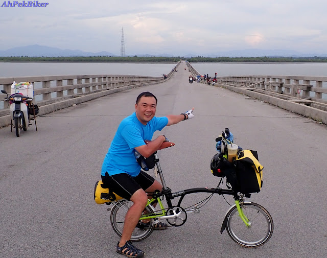
So here we are, happily waving on the Jambatan Tok Pasai Bridge which spans over the Sungai Kedah River.
 It's quite a tall bridge and below it we could see fishing boats slowly chugging out to sea.


(Click Here for Google route map link)

The rain petered off to a drizzle, and by nine we set off, 1-1/2 hours later than usual. Never mind, we will make up for it by cycling faster or perhaps have less stops along the way. Can we resist the temptations along the way?


It also shows the history of its sultans. Above is a portrait of HRH Sultan Muhammad Jiwa Zainil Azilin Muazzam Shah II who was the 19th Sultan of Kedah. He reigned from 1710 to 1778 and is widely known as the founder of Alor Setar and many current landmarks in the city are attributed to him. He was also the all time longest reigning Malay ruler in Malayan history and one of the longest reigning monarchs in the world after having ruled for a total of 68 years.


They sell their curry paste online, orders can be made to through their FB page: https://www.facebook.com/gulaitokpiah/. Or WhatsApp +6017-4247187.

Soon we were digging in, eating like the locals with our hands. The dreamy curry was so good that we went for seconds!

So here we are, happily waving on the Jambatan Tok Pasai Bridge which spans over the Sungai Kedah River.


After the bridge, we returned to try out the coastal road again; except for the absence of rubbish it was not much improvement from the previous tracks as it had lot's of potholes too. Never mind, let's be patient and just ride on and hope it improves.

Somewhere here we saw these racks holding burnt up giant joss sticks which are used in Chinese festivals. We found this quite interesting as this locality is a Malay area and we did not see any Chinese temple around. But their stark red colour contrasting with the bright green padi fields does make a picturesque scene.

After 3km. of the bad roads, at we decided to turn inland, onto a parallel road which although was not shady was in a very much better condition. Along this road, a canal with kampung houses lined one side and on the other side..... a wide expanse of green and every now and then flocks of egrets will fly fluttering by.

Further ahead, the padi fields ebbed away and it got shadier... thank goodness.
We passed by many villages, and again the local boys on their mosquito bikes came buzzing by, taunting us to race with them.

Near Kota Sarang Semut, a rest stop and a view of Gunung Jerai from afar.... while Brian had to repair another puncture!

We are on a roll now, our buddy Sin (of the hApPy HaPpY blogs) had taken a train up to Gurun, and from there a Grab Taxi to Pulau Bunting to meet us. In a rush we took the most direct route... MISTAKE! As after Kampung Sungai Tongkan the road became a sandy track which got narrower and narrower. Save for the odd motorcyclist and grazing goats, no one else uses this road.

Any way, to cut the story short, here we are united and riding on the Bunting Island Bridge that leads to Pulau Bunting. The island is so named as "Bunting" means pregnant in Bahasa Malaysia; the island does look like a pregnant woman's tummy.

Nearer the island, the bridge slopes upwards at a span held up by a cable-stay arch bridge.

Here's a photo showing how far this arch bridge is from the mainland (1.7km). The bridge continues on another 500 metres to Pulau Bunting. However, this bridge is not opened to traffic,concrete barricades had been put up at the mainland side .
Many locals come here riding in by motorcycles, some to picnic and enjoy the scenery, others to do some angling. The sad thing is many of these visitors just dirty the place by strewing rubbish all over.

6:30pm - With dusk setting in and us not having found accommodations for the night, we abandoned the coastal route and went onto the proper roads of State Route K1 where we could ride faster. At Yan Kecil, we stopped at one of the main street shops where a local advised that there are no accommodations in this town but there were some at Titi Serong and Pantai Murni. As we wanted to continue along the coast tomorrow, we opted for Pantai Murni.

At the Pantai Murni Waterfront there's a wide promenade good for a bit of cycling. At the far end is a covered sunken amphitheater.
 From the waterfront a long pier sticks out 350 metres into the sea.

 |
| Sunset at Pantai Murni. |
SELAMAT MALAM, SELAMAT BERMIMPI!
(that's "Good night, Sweet Dreams!" in Bahasa Malaysia)
(For more photos of the day Click Here)
This is page 3 of a 5-page blog, Click Here To Go To Title Page.
__________________________________________________________
Related Blogs:
 |
 |
 |
 |
 |
 |
You may also like:
 |
 |
 |
 |
 |
 |
 |
 |
| Street Art @ Hin Bus Art Depot, George Town, Penang : February 2014 An exhibition of interesting art by Lithuanian artist Ernest Zacharevic |
 |
 |
 |
 |
 |
 |
 |
 |
| Malaysia - KevinTheBigCity Tattoos, Kuala Lumpur : July 2014 A look at a young man's simple but meaningful tattoos. |
You are at - Jotaro's Blog / AhPek Biker / Cycling Malaysia / Perlis-Kedah-Penang / Perlis to Penang / Day 3 - Ayer Hitam To Yan | Go to D1 / D2 / D4 / D5
If you like this, view my other blogs at Jotaro's Blog
(comments most welcomed below. if you like this pls share via facebook or twitter)
(comments most welcomed below. if you like this pls share via facebook or twitter)
No comments:
Post a Comment