You are at - Jotaro's Blog / AhPek Biker / Cambodia / Mekong Islands Revisited
AhPek Biker - Riding Adventures
Cambodia : Mekong Islands Revisited

Solo Ride - Sangkat Phsar Thmey>Mekong Riverside>Arey-Ksat>Koh Oknha Tei>Koh Dach>Sangkat Chrouy Changva>Cambodia-Japan Friendship Bridge>>Sangkat Phsar Thmey
Cycling Distance Covered : approx. 27.27 km.
Time : 8:00 am - 11:45 am
Time Taken : 3 hrs. 45 mins. (including ferry rides, stops for drinks & photo shoots)
Route Recommendations :
1. For those who come from right-hand drive countries, bear in mind that in Cambodia vehicles are left-hand drive. So do take the extra care to ride on the correct side. When crossing roads, do bear this in mind, as vehicles will be coming in from the "wrong" direction.
2. Do take care when cycling along the wet laterite roads and the gravel roads, don't speed as the muddy roads can be rather slippery when wet; while the gravel roads can be rough on the bike.
3. What is seen as roads on maps at the outlying areas of Phnom Penh are in fact laterite tracks only.
5. Points of interests :
- Ferry Rides & the traders at the Ferry Ports
- The Cambodia-Japan Friendship Bridge.
- The "Prawn Temple" at Areyksat.
PRELUDE

The previous evening, I have taken a short riding stint around Phnom Penh, starting at the Mekong Riverside. With wide boulevards, the riverside is always a nice place to cycle at. Ride there in the morning or before 7:00 pm, after that the place gets very crowded and makes it hard to cycle.

Passing by the Ounalom Temple, I popped in for a quick visit to this largest temple in Phnom Penh. I often passed this place but had never taken the step to go in, and I have no regrets as the place turned out to be beautiful and interesting. Well, one regret though - I should have visited it much earlier in my previous trips.

Leaving the temple, I was heading towards another destination but the Independence Monument was to noticeable not to stop for a quick photo.

My destination the Wat Bottom Park, you must think this is an odd name for a park, I did too.
Google Maps had listed this place according to that name, luckily I double checked and it should be called the Wat Botum Park. The temple is to the left of the park; ahead can be seen the roofs of the Royal Palace. In the park is a water lily pond, but for today it was under maintenance and dry, devoid on any lilies.

So I took to admiring the statues in the park, like this one of a Garuda mythological bird. Yes, it's called Garuda just like in Bahasa Indonesia - the word is traced back to its Sanskrit origin.
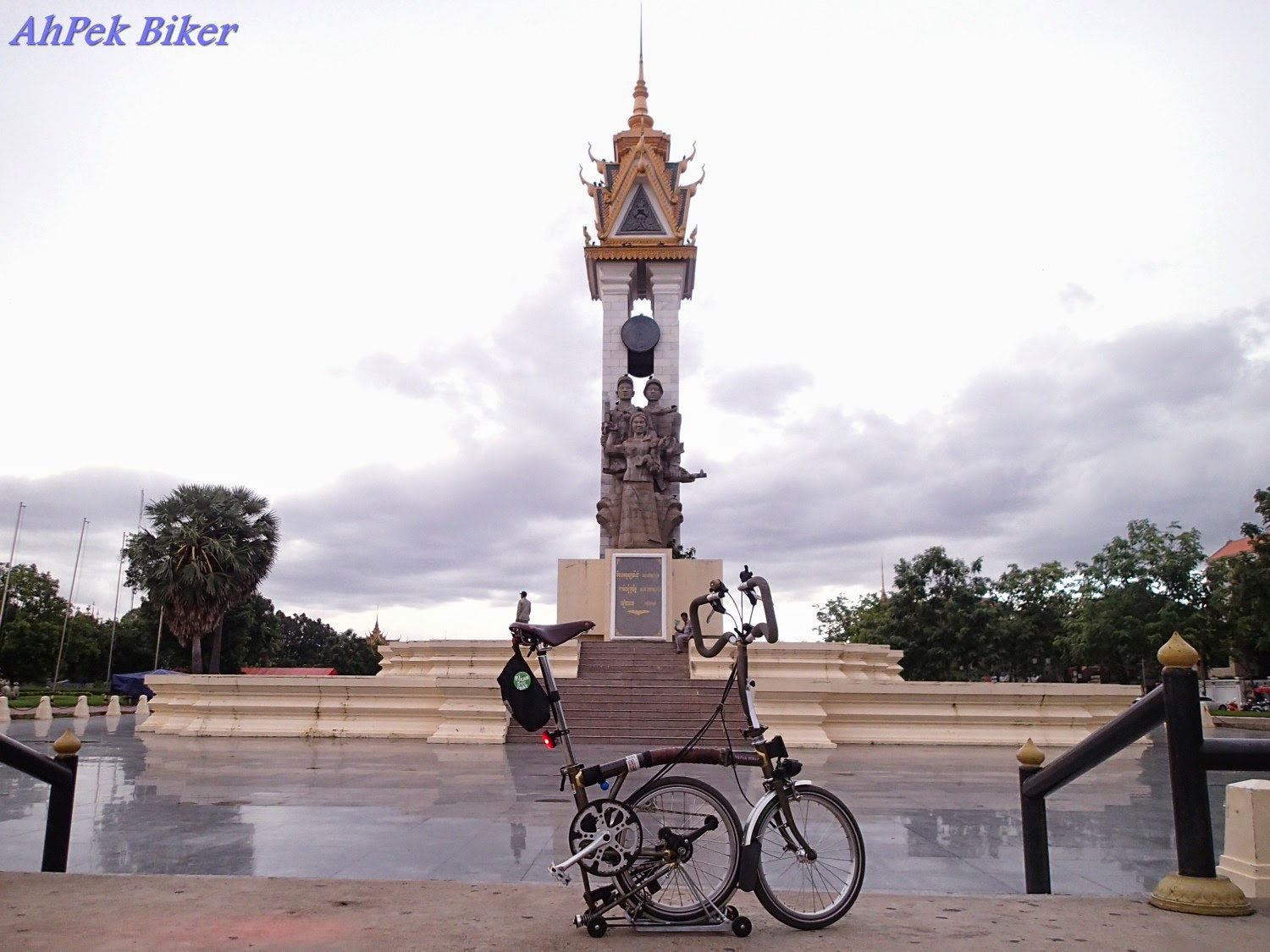
Within this park is the Cambodia-Vietnam Friendship Monument commemorating the alliance between the two countries.

The top of the monument has a nice tiered mini roof.

A close up of the statues shows two soldiers (one Cambodian, the other Vietnamese) with a Cambodian lady carrying a baby. I interpret this as the soldiers bringing peace to the country and now its people can grow.
THE RIDE
The previous evening ride just tickled my cycling itch more, it was too short and quick a ride. So this morning I decided to go riding to the Mekong Islands. I had previously rode this route as part of a cycling tour; this time round I will be riding myself.
I was riding without a GPS or a phone data plan, so I will be sort of "riding blind". Fortunately I had some of the route plans of the previous ride saved on my phone. Using these and memorizing critical turns I set off. For those unfamiliar with the route, I would advise the use of GPS units or at least get a local data plan. Bear in mind that sometimes data plan links can be interrupted by poor signal strengths.
View Mekong Island Cycling 2 (27.27km) in a larger map
Ride Route - Sangkat Phsar Thmey>Mekong Riverside>Arey-Ksat>Koh Oknha Tei>Koh Dach>Sangkat Chrouy Changva>Cambodia-Japan Friendship Bridge>>Sangkat Phsar Thmey
The route will take me from Phnom Phen City across the Mekong River over to Areyksat on the other side of the river and through three islands in the Mekong via three ferries and two main bridges.

8:00 am - In the early morning I rode off down the riverside to the Naga World ferry port and waited for the ferry to come. Actually it was not that early for me as I started after breakfast at the hotel. The sun rises at about 5:00 am in Cambodia, so one can start even earlier.

The "ferry ports" has no proper pier; the ferry arrives and the ferry's ram is lowered down like a military landing craft onto the river bank.
 Perhaps these ferries were former landing craft.

The first ferry took me over to Areyksat, the main land on the other side of the Mekong. Stretches of the road, especially near the ferry ports, are laterite or unpaved gravel roads making cycling not that easy.
 Some of the roads were shady, especially those near the ferry ports.
 But for most of the way, the roads are open and unshaded, milestones at the road side indicates distance to the next nearest big town. Tree planting on road shoulders don't seem to be the practice...
 ... probably because some of the locals use the road shoulders for planting fruits and vegetables.
 Besides, vegetables, most plant fruits like bananas, and mangoes in their compound to be self sufficient.
 Bicycles seems to be the regular means of transportation here. I spotted these children on a bicycle, the younger one pedalling carrying her sister who was carrying a baby. Irrespective of their poverty, they were happy as a lark.
 And this little girls was trying her best to manage a bike almost as tall a her.
 A cyclist vendor with his bicycle full of rattan baskets, brooms and duster, seems to handle his cycling well. With those long ceiling dusters, he reminds me knights of old. Charge....!
 A lady tuk-tuk driver ferrying a group of orange-robed monks.
 A horse-cart carrying fire wood; from it's muddy tires it must have rode into a swampy area.
That's what I like about riding in the rural areas, one gets to see scenes which is does not happen in the city.
 9:10 am - A quick stop for refreshments: coconut water, my favourite.
There are many of stalls selling food and drinks along the way, so there's no worries about replenishment. Coconut water, however is harder to find.
 There was some sort of celebration going on; according to the locals it was a Cambodian Harvest Festival. It's a festival that lasts as long as the harvest, sometimes up to a month.
Costumed participants will lead the way. The costumes don't seem to follow traditional Cambodian attire; the ones above seems to have come out from the "Pirates of the Caribbean" movie.
 This couple were costumed as traditional Japanese. They were followed by an entourage, most of them local children, as they went from house to house to give blessings for a good harvest and also accept donations.
 Frequently, the entourage includes a lion dance with the full ensemble of drums, gongs and cymbals.
 Part of the ritual includes the lion sprinkling the house owner with holy water.
 9:20 am - I have reached the Prawn Temple which I had passed by in an earlier North Phnom Penh Recce. Thank goodness I am on the right track, without a GPS unit or a data plan, I am using these landmarks as guides. I did not go in as I am fighting for time having to be back at the hotel by noon to check out and fly back to Malaysia.
 Ahead, I got a bit disorientated; the maps showed that the lane leading to the 2nd ferry port was in between a temple and a school (actually the map just showed two different coloured patches with no names, Google maps for Cambodia misses out such details). Trying a couple of lanes, I could not see any ferry and rode another 500 metres to explore other lanes. In the end, I found out that it was a lane just after and next to the temple. And was I glad to see people waiting at the end of that lane. Gosh!
 Here comes the second ferry, I was not surprised to see that it was a small, rickety timber vessel but a thought did cross my mind "What if it were to sink midway? There are no life jackets or floats! What will happen to my bicycle?"
 We were fortunate that the Mighty Mekong was calm and not angry with turbulent waters like it is during the monsoon season. the rickety ferry took us from Areyksat to Koh Oknha Tei safely.
 Google map showed the road leading to the Koh Oknha Tei Bridge as a straight road across the island with only a couple of short minor turns. But on ground everything looks different!
Suddenly the straight fairly wide road disappeared and in it's place were some narrow lanes in between house. Fortunately my sense of direction prevailed, and I managed to locate the narrow laterite road that led to the bridge.
Lesson learnt here, on the maps everything looks smooth and easy. On the ground expect things to be different!
The Koh Oknha Tei Bridge is a steel structure with a chequered plate deck spanning about 500 metres. Riding across it I had to be careful to avoid rivets that stick out or bent steel plates sticking upwards lest I suffer a puncture.
 After that, it was just a short quick ride through the southern tip of Koh Dach to reach the third ferry port, the Koh Dach Ferry Port. While waiting for the ferry to arrive, I noticed this monk striking a stunning sight with his orange robe contrasting against the river. He was deep in thought and I wondered what he was contemplating.
 The ferry here is large as this is a busy route. Two motorcyclists were transporting lemon-grass (a staple in Cambodian cooking) to Phnom Phen City.
 Back on the mainland, I rode down National Highway 6A on the outskirts of the city passing by several stalls selling porcelain saving boxes. The streets of Phnom Penh can get dusty especially during the dry season - for those who are not used to the dust, do wear face masks.
 Crossing the second major bridge - the Chroy Changvar Bridge also know as the Cambodia-Japan Friendship Bridge. Traffic is heavy on this bridge and a new bridge can be seen being constructed on the right to cater for even more traffic.
On both side of the bridge are motorcycle lanes and a pedestrian walkway, it is safe to cycle on the pedestrian walkway.
This bridge crosses the Tonle Sap River; so my journey actually took me across the two main rivers of Cambodia!
12:00 noon - I made it back to the hotel in time for a late check-out and later checked in for my flight back.
It had been a thrilling ride through three islands, crossing two rivers via three ferries and two bridges. But then it would have been more fun riding this route with friends.
SOOK SABAI!
(that's Cambodian for Goodbye.)
That's what I like about riding in the rural areas, one gets to see scenes which is does not happen in the city.
There are many of stalls selling food and drinks along the way, so there's no worries about replenishment. Coconut water, however is harder to find.
Costumed participants will lead the way. The costumes don't seem to follow traditional Cambodian attire; the ones above seems to have come out from the "Pirates of the Caribbean" movie.
Suddenly the straight fairly wide road disappeared and in it's place were some narrow lanes in between house. Fortunately my sense of direction prevailed, and I managed to locate the narrow laterite road that led to the bridge.
Lesson learnt here, on the maps everything looks smooth and easy. On the ground expect things to be different!
 |
| First major bridge crossing - the Koh Oknha Tei Bridge. |
On both side of the bridge are motorcycle lanes and a pedestrian walkway, it is safe to cycle on the pedestrian walkway.
This bridge crosses the Tonle Sap River; so my journey actually took me across the two main rivers of Cambodia!
 |
| Sandstone bust of Lokeshvara at Phnom Penh International Airport. |
It had been a thrilling ride through three islands, crossing two rivers via three ferries and two bridges. But then it would have been more fun riding this route with friends.
SOOK SABAI!
(that's Cambodian for Goodbye.)
Related Blogs :
 |
 |
 |
 |
 |
 |
| Cambodia : Phnom Penh Museums : December 2012 A surprisingly educational visit to the National Museum of Cambodia. |
 |
 |
You may also like:


 |
 |
 |
 |
You are at - Jotaro's Blog / AhPek Biker / Cambodia / Mekong Islands Revisited
If you like this, view my other blogs at Jotaro's Blog
(comments most welcomed below. if you like this pls share via facebook or twitter)
No comments:
Post a Comment