You are at - Jotaro's Blog/AhPek Biker/Cycling Route Maps/Malaysia/Kuala Lumpur Cycling Route Maps
AhPek Biker - Riding Adventures
Kuala Lumpur Malaysia Cycling Route Maps
Below are maps of routes that my pals & me cycled in Kuala Lumpur. These were routes we cycled at Kuala Lumpur and it's outskirts, exploring and discovering views that one seldom see by car. Our rides took us to view temples, processions, etc. Heck! We even rode through cemeteries! (... to view those rides click here to see Cycling Kuala Lumpur).
Click on relevant screen zoom rectangle (at the top right hand corner of each map) to go to the respective route map:
River of Life Brickfields Loop Kuala Lumpur Cycling Route Map (12.13 km)
KUALA LUMPUR RIVER OF LIFE: BRICKFIELDS LOOP CYCLING ROUTE MAP:
This is a easy flat route that goes mostly along cycling pedestrian paths running along the Klang River. Starting from Dataran Merdeka, it goes along shared lanes to the Pasar Seni before cutting onto cycling lanes leading to Brickfields and ahead to the South-West Dedicated Cycling Highway before looping back across the Robson Bridge onto lanes running beside the Federal Highway Riverside. After which it goes down into the Park Harmoni pedestrian roundabout (below Jalan Kinabalu) to lead to the Taman Budaya and then back to Dataran Merdeka.
Cycling Distance: 12.13 km. Level: Easy
___________________________________________________________________________________
River of Life Chow Kit Loop Kuala Lumpur Cycling Route Map (2.74 km plus)
KUALA LUMPUR RIVER OF LIFE: CHOW KIT LOOP CYCLING ROUTE MAP:
Dataran Merdeka>Chung Kwok Shool>Putra Mall-Tiong Nam>Guiding Light Cafe>PWTC Spriral Bridge>Tun Razak Fire Station.
(Click here for the KL River of Life Chow Kit Cycling Route Map - Google Map Link)
This is a easy flat route that goes partly along cycling pedestrian paths running along the Gombak River up till its Batu River confluence, and slightly beyond.
Starting from Dataran Merdeka, it proceeds along the shared blue cycling paths along Jalan Raja Laut and Jalan Merpati. At entry near SJK (C) Chung Kwok, it goes onto dedicated paths along the Gombak River reaching up to Jalan Tun Razak; another branch goes to Jalan Sultan Azlan Shah (formerly Jalan Ipoh).
From here, going along public roads one can reach the riverside paths at Sungai Batu-Sungai Keroh. Another extension is the Sungai Bunus riverside paths near Taman Tasik Titiwangsa.
Cycling Distance: 2.74 km. (round loop) Level: Easy
(Zoom out to see extended route to Sungai Bunus-Titiwangsa and Sungai Batu-Sungai Keroh)
Sg Bunus Secondary Loop: Dataran Merdeka>Jalan Ampang>Saloma Bridge>Kampung Baru>Sungai Bunus-Lg Gurney Entry>Taman Tasik Titiwangsa.
Sg Batu Secondary Loop: Spriral Bridge>Jalan Ipoh>Jalan Kasipillay>Choo Sing Tang Temple.
___________________________________________________________________________________
River of Life Chow Kit West Bank Trail Kuala Lumpur Cycling Route Map (1.7 km loop)
KUALA LUMPUR RIVER OF LIFE: CHOW KIT WEST BANK CYCLING ROUTE MAP:
Tun Razak Fire Station>New Steel Pedestrian Bridge>Putra Riverside Food Court>Sunway Putra Mall Riverside Entry>Walking path@River of Life>Stairs to Regalia>Regalia Suites>Tun Razak Fire Station.
This is a short flat route that goes along cycling/walking paths running along the west bank of the Batu River and Gombak River, starting from a new pedestrian bridge at Lebuhraya Sultan Iskandar (that spans over the Batu River). It starts near the Tun Razak Fire Station and goes for about 0.85km till the Regalia Suites. At the start it is just a narrow walk-path wide enough for a single bike, after the Sunway Putra Mall, it slowly widens to proper path which are nicely landscaped and lit at night.
Cycling Distance: 1.7 km. Level: Very Easy
___________________________________________________________________________________
Ampang Park Station to Lebuh Pasar Kuala Lumpur Cycling Route Map (10.20 km)
Cycling Route : Ampang Park LRT Station>Pavilion Mall>Jalan Ipoh>Odeon Cinema>Medan Pasar
Distance: 10.20km Level: Very Easy.
This is the one of the routes of the Kuala Lumpur Critical Mass ride which is held every last Friday evening of the month. Riders meet at the Ampang Park LRT Sation, opposite the Ampang Park Shopping Mall at 9:00 pm.
___________________________________________________________________________________
Bukit Kiara to Desa Park City to Segambut & Back Kuala Lumpur Cycling Route Map (30.0 km)
Cycling Route: Royal Selangor Club, Bukit Kiara>Kuala Lumpur Golf & Country Club>Bukit Kiara>Taman Tun Dr. Ismail>Kampong Sg Pencala>Desa Park City>Segambut>Desa Sri Hartamas>Royal Selangor Club.
Distance: 30.00km Level: Medium.
The route takes one from the Royal Selangor Club to the hills of Bukit Kiara then onwards Segambut via the pristine Kampong Sg Pencala and the township of Desa Park City. A very nice route that takes us through hills and rustic villages.
___________________________________________________________________________________
Dataran Merdeka to Batu Cantonment Jln Ipoh & Back Kuala Lumpur Cycling Route Map (23.91 km)
Cycling Route: Dataran Merdeka>Bukit Tunku>The Mall>Sentul>Batu Cantonment>Jalan Ipoh>Dataran Merdeka
Distance: 23.91km Level: Easy.
Our aim was to ride from Dataran Merdeka to usher in the Chinese New Year of 2014 by having dinner at one of our favourite restaurants, Laomazis at Jalan Ipoh. Cycling straight there would have been a cinch, but then Tailim (of the hApPy HaPpy blogs) took us on a round about way. It was a longer route that would take us on interesting paths and bridges through the Sentul and Batu Cantonment areas.
___________________________________________________________________________________
Dataran Merdeka to Batu Metropolitan Park & Back Kuala Lumpur Cycling Route Map (24.28 km)
Cycling Route: Pasar Seni>Dataran Merdeka>Tiong Nam Gombak Riverside>Jalan Ipoh>Kasipillay Batu Riverside>Batu Metropolitan Park>Chow Kit>Dataran Merdeka>Pasar Seni.
The route is fairly flat and takes us from Dataran Merdeka to the Batu Metropolitan Park located at the Sentul district, on the northern part of Kuala Lumpur. It will take us along part of the River of Life and along riverside paths of two rivers - the Gombak River & Batu River.
Cycling Distance: 26.15 km. Level: Medium
Cycling Distance: 26.15 km. Level: Medium
___________________________________________________________________________________
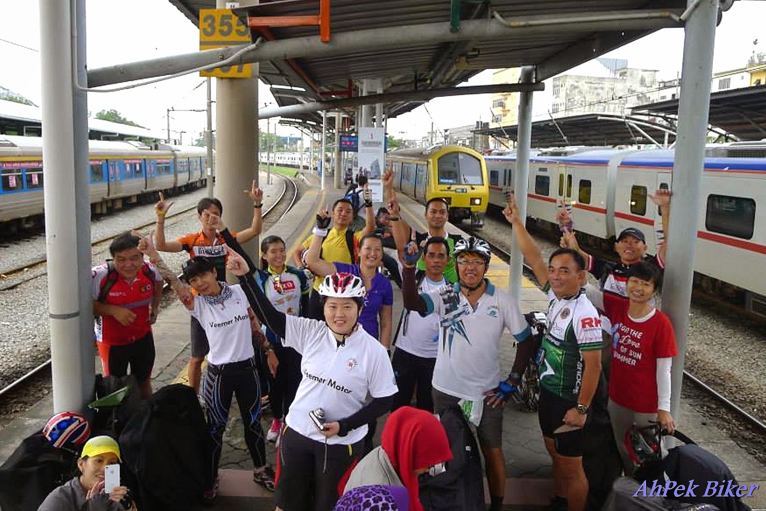
Dataran Merdeka KL to Klang Town & Back by Train Kuala Lumpur Cycling Route Map (73.78 km)
Cycling Route: Dataran Merdeka>Brickfields>Federal Highway Motorcycle Lane>Klang>Jalan Templer Station (by train)>Old Klang Road>Brickfields>Sultan Abdul Samad Bldg
Distance: 73.78km (including train ride) | Level: Medium.
From Sultan Abdul Samad Bldg to Klang for Bak Kut Teh via Brickfields and the motor-cycle lanes of the Federal Highway. Back is partly by train and then cycling along the storm-water drains of the Klang River to view the street-art murals.
____________________________________________________________________________________________________________________________________________________________
Dataran Merdeka to Petaling Jaya Thai Temple Via Kwong Tong Cemetery Kuala Lumpur Cycling Route Map (31.60 km)
Cycling Route: Dataran Merdeka KL>Maha Vihara Temple, Brickfields>Thean Hou Temple>RMAF Museum>Taman Dusun Bellamy>Old Istana Negara>Federal Highway>
Thai Chetawan Temple, Petaling Jaya>Raju Banana Leaf Rice>Federal Highway>Brickfields>Dataran Merdeka KL.
Distance: 31.60km Level: Medium.
This is another "Head where the wind take us ride", i.e. just cycle along and go where we felt like it. This time we started at Dataran Merdeka and headed to the Thai Chetawan Temple in Petaling Jaya. Enroute we passed by cemeteries and visited several temples, the Old National Palace and even an air-force museum!
___________________________________________________________________________________
Dataran Merdeka to Taman Sri Rampai Kuala Lumpur Cycling Route Map (26.35 km)
Distance: 26.35km Level: Medium.
The route starts from Dataran Merdeka heads towards Titwangsa and then onwards to Selangor Pewter at Taman Sri Rampai.
_________________________________________________________________________________
Dataran Merdeka to Seputeh Kuala Lumpur Cycling Route Map (22.98 km)
This is a fairly flat route except for some climbs at the Taman Seputeh area; it is shady along the cycling lanes, Taman Seputeh & Bukit Petaling areas but is very open & un-shaded at the cemeteries.
Cycling Distance: 22.98 km. Level: Medium
Cycling Distance: 22.98 km. Level: Medium
_________________________________________________________________________________
Genting Sempah & More Kuala Lumpur-Selangor Cycling Route Map (91.35km)
Distance: 91.35 km. Level: Hard
The route starts off passing through the residential suburbs of Setiawangsa and Wangsa Maju; and continues rural and secondary jungle from Jalan Gombak. After the Hospital Orang Asli (HOA) the road is a continuous until Genting Sempah before sloping down to Bukit Tinggi.
The route starts off passing through the residential suburbs of Setiawangsa and Wangsa Maju; and continues rural and secondary jungle from Jalan Gombak. After the Hospital Orang Asli (HOA) the road is a continuous until Genting Sempah before sloping down to Bukit Tinggi.
___________________________________________________________________________________
Kepong To KLCC Kuala Lumpur Cycling Route Map (30.0 km)
Cycling Route: Kepong Baru>Segambut>Jalan Ipoh>Kampung Baru>Pavilion Mall>Kuala Lumpur Convention Centre>Malasian Tourism Information Centre (MATIC)>Jalan Ipoh>Segambut>Kepong Baru.
This is a straight forward route from Kepong Baru to KLCC. It is fairly flat and goes along residential roads, bike paths, and partway on busy main roads (very minimum of that).
Cycling Distance - 34.82 km. Level: Medium
Cycling Distance - 34.82 km. Level: Medium
___________________________________________________________________________________
Kuala Lumpur Inaugral Cycling Lanes - From Dataran Merdeka to Midvalley Kuala Lumpur Cycling Route Map (4.89 km)
Cycling Route: Dataran Merdeka>Brickfields>Klang Riverside>Midvalley
Distance: 4.89km Level: Easy.
The cycling lanes starts from Dataran Merdeka runs along the Klang River for most of its length and ends near the Mid Valley Megamall. For most of its length it is a dedicated cycling lane; some sections (a major stretch in Brickfields) are shared with other traffic while some others are shared with pedestrians. At close to five kilometres it is not very long and can be completed within half an hour (one-way), but it will be good to take one's time at certain stretches to admire the beauty there.
(.... click here to view Ride Blog)
___________________________________________________________________________________
Kuala Lumpur Cycling Lanes 2 - Around the Commercial Heart of the City Kuala Lumpur Cycling Route Map (6.80 km)
The new lanes is a loop that starts from Medan Pasar and leads to the Petronas Twin Towers via Jalan Raja Chulan and Jalan P. Ramlee. The return leg is via Jalan Ampang, Jalan Sultan Ismail and Jalan Raja Laut.
Distance: 6.80km Level: Easy.
___________________________________________________________________________________
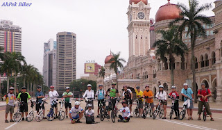
Merdeka Stadium to Lake Gardens to KLCC Kuala Lumpur Cycling Route Map (22.33 km)
Cycling Route: Stadium Merdeka>Lake Gardens>National Monument>KLCC>Imbi>Stadium Merdeka.
Distance: 22.33km Level: Easy.
This is a ride to celebrate Malaysia's National Independence Day and aptly we cycled around Kuala Lumpur to visit the sites that commemorate the independence day.
(.... click here to view Ride Blog)
___________________________________________________________________________________
Pudu to Ampang Old Town to Bt. 14 Ulu Langat & Back Kuala Lumpur Cycling Route Map (43.60 km)
Cycling Route: Pudu > Ampang > Batu 14 Hulu Langat & back.
Distance: 43.60km Level: Medium
One of my earlier rides, in a way it's a ride for eats. Starting from Pudu we cycled to try the renown Ampang Yong Tow Foo then continued to Batu 14 Hulu Langat for drinks at a small coffee shop. At the end of the ride we had a good roast duck/goose lunch at Siew Ngap Fai.
One of my earlier rides, in a way it's a ride for eats. Starting from Pudu we cycled to try the renown Ampang Yong Tow Foo then continued to Batu 14 Hulu Langat for drinks at a small coffee shop. At the end of the ride we had a good roast duck/goose lunch at Siew Ngap Fai.
___________________________________________________________________________________
Setapak to Titiwangsa to Ampang & Back Kuala Lumpur Cycling Route Map (32.30 km)
In supporting the Earth Hour Organisation in protecting our planet, we rode this route organised by Share Our Roads Malaysia.
(.... click here to view Ride Blog)
___________________________________________________________________________________
Bandar Sunway To Batu Caves Selangor-Kuala Lumpur Cycling Route Map (34.82km)
___________________________________________________________________________________
Taman Tun Dr Ismail to Loke Yew Cemetery Via University Malaya & Brickfields Kuala Lumpur Cycling Route Map (50.00 km)
Cycling Route: Taman Tun Dr. Ismail>Tropicana City>Section 17 PJ>University Malaya>Thean Hou Temple>Brickfields>Kwong Tong Cemetery>Taman Dusun Bandar Bellamy>Istana Negara>Section 14 PJ & Back.
Distance: 50+km Level: Hard.
This was a ride which we rode with no clear route in mind, just a rough idea of directions and where we wanted to go, i.e. getting from Taman Tun Dr. Ismail down to Brickfields and the Istana Negara. Enroute we visited Thean Hou Temple, rode through cemeteries and "discovered" a lost park right in the centre of Kuala Lumpur.
(.... click here to view Ride Blog)
___________________________________________________________________________________
Titiwangsa to Cheras Kuala Lumpur-Selangor Cycling Route Map (40.63km)
MORE KUALA LUMPUR CYCLING ROUTE MAPS COMING SOON.
Cycling Route : Tmn Sri Rampai>Tmn Tasik Titiwangsa>Jln Tun Razak>Kg Pandan>Tmn Setiawangsa>Wangsa Maju>Tmn Sri Rampa
Distance: 32.30km Level: Medium.In supporting the Earth Hour Organisation in protecting our planet, we rode this route organised by Share Our Roads Malaysia.
(.... click here to view Ride Blog)
___________________________________________________________________________________
Bandar Sunway To Batu Caves Selangor-Kuala Lumpur Cycling Route Map (34.82km)
Cycling Route:Bandar Sunway>Petaling Jaya Old Town>Pantai Dalam>Brickfields>Dataran Merdeka>Jalan Sentul>Batu Metropolitan Park>Batu Caves>by KTM Komuter>Setia Jaya>by BRT bus>Bandar Sunway.
The route goes along residential roads, bike paths, on pedestrian bridges crossing busy highways and railroads, and partway on busy main roads (very minimum of that). It is fairly flat.
Cycling Distance - 34.82 km. Level: Medium
(.... click here to view Ride Blog)Cycling Distance - 34.82 km. Level: Medium
___________________________________________________________________________________
Taman Tun Dr Ismail to Loke Yew Cemetery Via University Malaya & Brickfields Kuala Lumpur Cycling Route Map (50.00 km)
Cycling Route: Taman Tun Dr. Ismail>Tropicana City>Section 17 PJ>University Malaya>Thean Hou Temple>Brickfields>Kwong Tong Cemetery>Taman Dusun Bandar Bellamy>Istana Negara>Section 14 PJ & Back.
Distance: 50+km Level: Hard.
This was a ride which we rode with no clear route in mind, just a rough idea of directions and where we wanted to go, i.e. getting from Taman Tun Dr. Ismail down to Brickfields and the Istana Negara. Enroute we visited Thean Hou Temple, rode through cemeteries and "discovered" a lost park right in the centre of Kuala Lumpur.
(.... click here to view Ride Blog)
___________________________________________________________________________________
Titiwangsa to Ampang to KLCC to Chow Kit & Back Kuala Lumpur Cycling Route Map (15.70 km)
Distance: 15.70km Level: Easy
It's a short ride just to warm us up for a 2015 pre-Chinese New Year reunion dinner. The route takes us from Titiwangsa to Ampang via and into the interesting storm-water drains at the Walls of AKLEH.
(.... click here to view Ride Blog)
It's a short ride just to warm us up for a 2015 pre-Chinese New Year reunion dinner. The route takes us from Titiwangsa to Ampang via and into the interesting storm-water drains at the Walls of AKLEH.
(.... click here to view Ride Blog)
___________________________________________________________________________________
Titiwangsa to Ampang Old Town & BackKuala Lumpur Cycling Route Map (21.86 km)
Cycling Route - Tasik Titiwangsa>Korean Embassy>Ampang Old Town>9-Emperor Gods Temple>Tasik Titiwangsa
Distance: 21.86km Level: Easy
This is the route we took to ride from the Titiwangsa Golf Club to Ampang Old Town to view the 9-Emperor Gods procession. En route we passed by the newly built Korean Embassy to admire its architecture.
(.... click here to view Ride Blog)___________________________________________________________________________________
Titiwangsa to Cheras Kuala Lumpur-Selangor Cycling Route Map (40.63km)
Cycling Route - Titiwangsa>South Korean Embassy>Tim Mei>Chuan Kee>Bodhi Cheras>Loke Yew Round-a-bout>Kampong Bharu>Titiwangsa.
Cycling Distance - 40.63 km. Level: Medium
The route goes along residential road, pedestrian walkways, river-side pathway and avoids main roads as much as possible.
The route goes along residential road, pedestrian walkways, river-side pathway and avoids main roads as much as possible.
___________________________________________________________________________________
Titiwangsa KL to SS2 Petaling Jaya Kuala Lumpur Cycling Route Map (63.00 km)
Cycling Route : Titiwangsa Golf Club>Jalan Ipoh>Jinjang>Kepong>Sg Pencala>Taman Tun Dr Ismail>Bandar Utama>SS2>Section 17>University Malaya>Federal Highway>Brickfields>Dataran Merdeka>Titiwangsa Golf Club
Distance: 63.00km Level: Hard.
It's a super loop that takes us from Titiwangsa to SS2 in Petaling Jaya just to eat durians and then happily cycling back. En route we passed by the residential areas of Kepong, Jinjang, etc. This route also passes two riverside tracks at Batu River and Klang River.
(.... click here to view Ride Blog)
___________________________________________________________________________________
Wangsa Maju to Klang Gates to Kg. Kemensah & Back Kuala Lumpur Cycling Route Map (50.80 km)
Cycling Route: Carrefour Wangsa Maju>Klang Gates Dam>Zoo Negara>Kemensah.
Distance: 50.80km Level: Medium.
The route takes us from Wangsa Maju through Taman Melawati to the Klang Gates Dam. And then contiunue on towards Kampung Kemensah where thereh is a waterfall suitable to for a cooling swim.
(.... click here to view Ride Blog)
___________________________________________________________________________________
STAY TUNED!
Related Blogs :
 |
You May Also Like :
 |
 |
 |

 |
 |
 |

 |
 |


 |
 |
 |

You are at - Jotaro's Blog/AhPek Biker/Cycling Route Maps/Malaysia/Kuala Lumpur Cycling Route Maps
If you like this, view my other blogs at Jotaro's Blog
(comments most welcomed below. if you like this pls share via facebook or twitter)
No comments:
Post a Comment